Han Jiang
Subtitle: The Lifeline of Chaoshan: A Journey Along the Han River
1. Introduction: From "Crocodile Creek" to Han River
Flowing as the second longest river in Guangdong Province, the Han River, with its total course stretching approximately 410 kilometers, is far more than a mere geographical feature. It is the indispensable lifeblood, the historic conduit, and the central scenic artery of the Chaoshan region (encompassing Chaozhou, Shantou, and surrounding areas). Its journey from mountainous origins to the South China Sea mirrors the rich cultural evolution of the lands it nourishes. Historically feared and named "E Xi" or "Crocodile Creek" for the reptilian predators that once infested its waters, its destiny was irrevocably changed by the famed Tang Dynasty literatus and official, Han Yu. To commemorate his efforts in subduing the crocodile menace and bringing civilization to the region, the river was renamed in his honor. Today, the Han River presents a captivating blend of powerful natural scenery, ancient engineering marvels, and poetic vistas that have been celebrated for centuries.
2. The River's Course: From Confluence to Delta
2.1. Origins and Confluence The Han River's formation is a union of two major tributaries originating from the mountainous borders of Jiangxi, Fujian, and Guangdong. The Ting River, flowing from the southwestern Wuyi Mountains in Fujian, journeys southeast. The Mei River, originating from the highlands between Zijin and Lufeng counties in Guangdong, courses northeast. These two powerful streams converge dramatically at a place known as Sanheba in Dabu County. It is at this pivotal junction that the mighty Han River truly begins, its volume and power significantly augmented.
2.2. The Middle Reaches: Through the Heart of Chaozhou From Sanheba, the newly formed Han River flows southward for about 110 kilometers, its waters swift and turbulent as it gathers smaller streams from the surrounding hills. This middle section brings the river to the very gates of the ancient city of Chaozhou. Here, the river runs for approximately 3 kilometers along the city's edge, its northern stretch broad and imposing. The historic North Dyke, linking Zhugan Mountain and Jin Mountain, stands as a silent guardian that has protected the old city from floods for generations. This segment of the river is where history and landscape are most intimately intertwined.
2.3. The Delta: A Fan of Waterways to the Sea At Chaozhou, below the iconic Xiangzi Bridge, the Han River begins its final transformation. It fans out into a fertile delta plain, splitting into a network of distributaries that gently weave their way to the coast. The main branches are the Northern Stream (Beixi), the Eastern Stream (Dongxi), and the Western Stream (Xixi). These streams further subdivide, creating a complex aquatic network that irrigates the lush farmland of the plain and serves as vital commercial waterways. The Eastern Stream flows into the sea via Beigang, the Northern Stream combines with the artificial Nanxi Canal to form the Dongli Stream, and the Western Stream branches into channels like the Waisha, Xinjin, and the critically important Meixi, which flows directly through the heart of Shantou city before emptying into Shantou Harbor. This delta system is the economic and agricultural engine of the entire Chaoshan region.
3. Scenic Masterpieces: The Han River in Chaozhou's "Eight Views"
The Han River's flow through Chaozhou has inspired poets and painters for centuries, giving rise to several of the famed "Chaozhou Eight Scenes," each capturing the river's mood in different seasons and conditions.
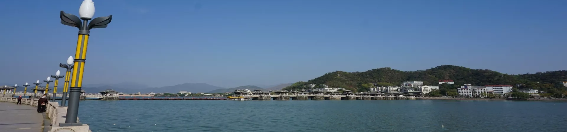
3.1. Xiangzi Bridge and the "Spring Swell at Xiang Bridge" (湘桥春涨) Dominating the river's mid-section in Chaozhou, the ancient Xiangzi Bridge (also known as Guangji Bridge) is a marvel of Song Dynasty engineering. This unique pontoon bridge with stone boat piers and a movable central section has connected the old city with the eastern shore for nearly a millennium. The scene is most powerful during the spring floods, when the surging waters crash against its sturdy piers, creating a spectacle of roaring water and mist—a sight celebrated as the "Spring Swell at Xiang Bridge."
3.2. The "Autumn Wind at Crocodile Ferry" (鳄渡秋风) North of the city, where the river is wide, one can imagine the historical "Crocodile Ferry." Here, the atmosphere turns tranquil and lyrical. With tall kapok trees lining the dyke and traditional ferries or sailboats drifting across the current, the scene is particularly evocative on a crisp autumn day when the wind fills the sails. This poetic tableau commemorates the area's ancient lore and is known as the "Autumn Wind at Crocodile Ferry."
3.3. Phoenix Terrace and "Rain at Phoenix Islet" (凤凰时雨) Further south, the river divides to embrace the Phoenix Islet (Fenghuang Zhou). At its tip stands the elegant Phoenix Terrace (Fenghuang Tai). During the rainy season, ascending this terrace offers a mesmerizing view. The river and sky merge into a curtain of misty rain, through which the outline of the Xiangzi Bridge faintly appears and disappears. This ethereal, painterly scene is immortalized as "Rain at Phoenix Islet."
3.4. Dragon Pool Pagoda and "Precious Pagoda at Longqiu" (龙湫宝塔) Directly opposite the Phoenix Terrace, on the river's western bank, stands the majestic Phoenix Tower (Fenghuang Ta), often referred to in this context as the Dragon Pool Pagoda. This Ming Dynasty stone and brick pagoda rises sharply from the water's edge. Its solid, towering form is perfectly reflected in the calm river below, creating an image of immense stability and beauty, celebrated as the "Precious Pagoda at Longqiu."
4. Hydrology and Practical Information
4.1. Flow and Flood Season The Han River's flow is predominantly fed by rainfall, with its annual discharge closely tied to precipitation patterns. Its hydrological cycle is marked by a distinct flood season, which typically runs from April through September. The peak flow and highest water levels usually occur in June, when the river is at its most powerful and voluminous.
4.2. Visiting the River The scenic stretches of the Han River, particularly around Chaozhou's ancient city, are accessible public spaces. There are no general admission fees to walk along the dykes, view the Xiangzi Bridge, or see the Phoenix Terrace from the outside. Specific attractions like ascending the Phoenix Tower or crossing certain sections of the Xiangzi Bridge may have separate, minimal fees. It is advisable to check the latest details for specific sites or boat tours directly with local operators or at the scenic spots.
4.3. Accessibility The banks of the Han River in Chaozhou's urban area are developed for tourism and leisure, making them easily accessible for visitors. The area is essentially an open scenic zone, allowing for exploration at any time of day. The most enchanting experiences often come at dawn, when the city awakens, or at dusk, when the ancient structures are illuminated against the darkening sky, casting shimmering reflections upon the enduring waters of the Han.